Standing at 5,895 meters, Mount Kilimanjaro is the tallest freestanding mountain in the world and a dream destination for trekkers from around the globe. Whether you prefer gradual ascents with added comfort, remote wilderness trails, or the challenge of a steep climb, Kilimanjaro offers routes suited to every experience level. With routes for every experience level, the climb takes you through varied landscapes, from mossy rainforests and sweeping moorlands to the rocky alpine desert and icy arctic summit. Each journey promises breathtaking landscapes to views of glacial ice fields and rolling valleys and unforgettable memories. Our expert guides will help you reach the iconic Uhuru Peak, a life-changing achievement.
It has three distinct volcanoes. Our treks take you to these iconic sites.
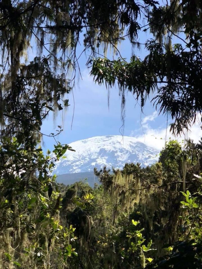
Kibo, the highest volcano, sits at the center of the mountain. It has an 11-km “saddle,” which is the lowest point of a ridge between two peaks. Kibo has a large caldera (crater) on its southern side, where you can see residual volcanic activity. Only Kibo still has a permanent ice cap.
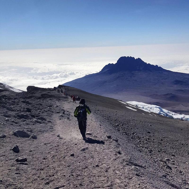
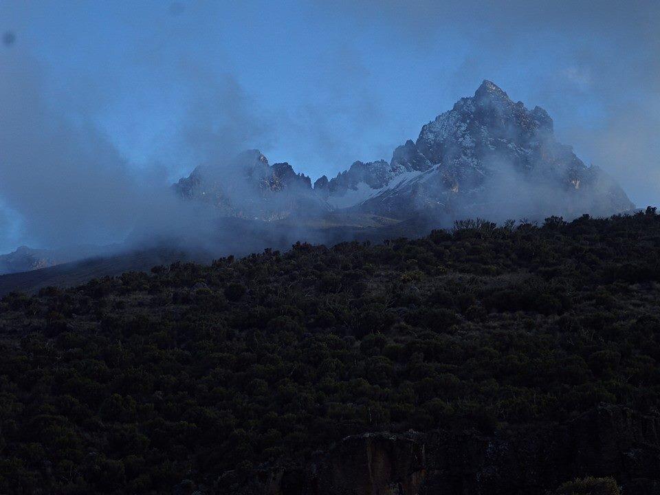
Mawenzi is on the east side of the mountain. Mawenzi’s cone is highly eroded, jagged, and precipitous and is cleft on the east and west by gorges. Mawenzi has semi-permanent ice patches and seasonal snow.
Shira, the lowest of Kilimanjaro’s three volcanoes, lies on its western slope. Shira Ridge is a remnant of an earlier crater.
Land2Ice will also take you to many other fascinating spots on the mountain, including:
(800 to 1800 m)
The foothills of the mountain have fertile soil and an abundance of rainfall.

(1800 to 2800 m)
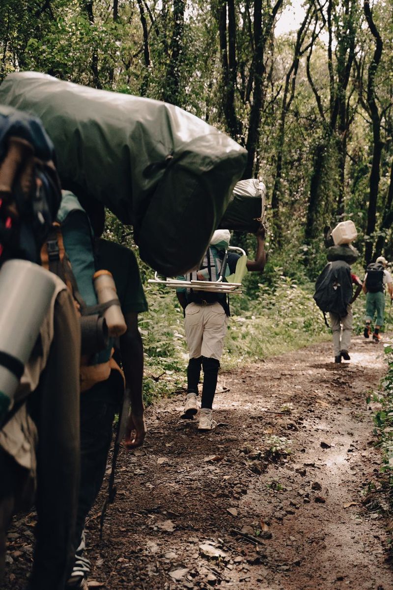
Towering, moss-covered trees, and rushing streams are home to an abundance of wildlife, including colobus monkeys, baboons, buffalo, and many others.

(2800 to 4000 m)
Large expanses of open grassland with low-growing shrubs and alpine flowers

(4000 to 5000 m)
Volcanic rock and plant life adapted to alpine conditions, outstanding views of Kibo and the countryside far beyond.

(5000 to 5895 m)
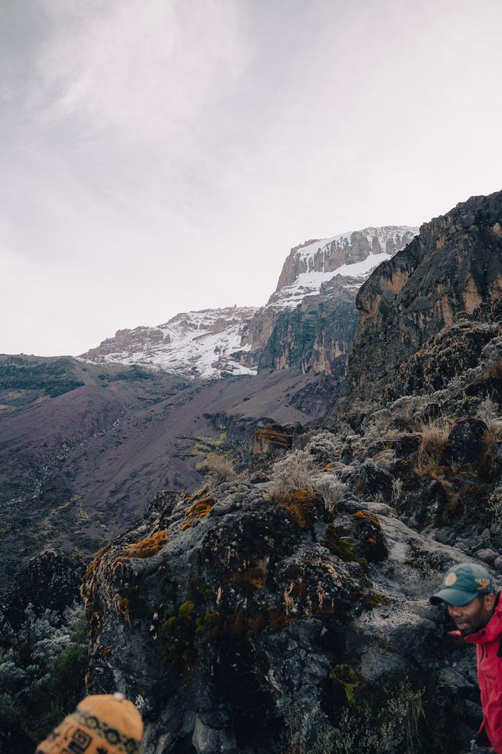
The steepest slopes of the mountain, consisting of scree, loose dirt, gravel, and ice. A glacial summit includes the Rebmann glacier, a remnant of the ice cap that once covered Kilimanjaro’s summit.

Pay attention to your body and keep your guide informed of any signs of altitude sickness.
Stay well hydrated
Pace yourselves
Ask for help when you need it!
Please plan to tip all porters, cooks, game ranger (if present on your climb), and guides, who will support you on your mountain trek.
All staff depend on tips to supplement their income in order to achieve a livable wage
Cash tips are typically given to each staff member in a tipping ceremony, after you reach the gate at the end of your climb.
Land2Ice is a partner with the Kilimanjaro Porters Assistance Project (KPAP). For more information, please visit the Kilimanjaro Responsible Trekking Organization website.
We offer a variety of treks for you to choose from. They each follow different routes and take a different number of days. For every trek, we pick you up at the Kilimanjaro International Airport and drive you to the hotel you have booked for yourself in Moshi town. There you meet your guide, who briefs you on the details of the trek. The guide also checks your equipment, to ensure you have all the necessary mountain gear. You can rent any gear if needed.

Each route comes with pros and cons. The following chart provides some quick statistics about each route, and you can read more details below.

The Lemosho Route has become one of the most popular trails up Kilimanjaro. With a longer, more flexible schedule, hikers have the most time to acclimatize and, therefore, experience the highest success rate. Lemosho offers unique views of the remarkable landscape, wildflowers, and surrounding valleys. It approaches Uhuru from the west, ascending both the Lava Tower and the dramatic Barranco Wall, and traverses beneath the Southern Ice Field before reaching Barafu Camp the evening before the summit ascent.
The Machame Route is the most popular trail to Uhuru peak, as it is considered the most scenic, passing through varied, distinct ecosystems on each day of the climb. It offers stunning views of the Shira Plateau, Mawenzi Peak, Mt. Meru, and the expansive Tanzanian countryside below. Machame is known as the “Whiskey Route,” because with longer days, more elevation changes, and steeper ascents, it is more challenging than the “Coca Cola,” or Marangu Route. Yet hikers also acclimatize more by spending three consecutive nights at higher elevation, and therefore experience a higher success rate.
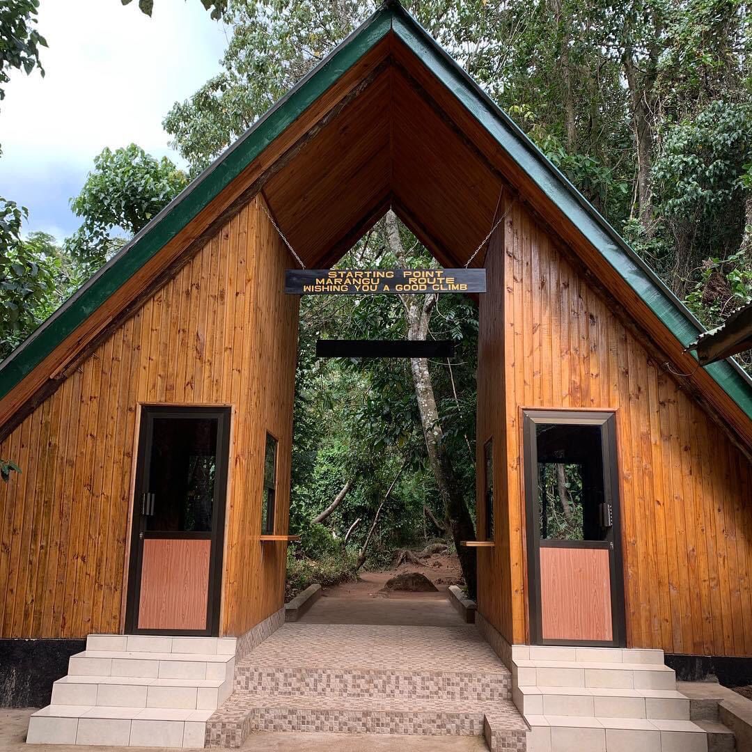
The Marangu Route, also known as the Coca-Cola Route, is the oldest route in Kilimanjaro Park. With fewer steeper climbs, it is also one of the easiest trails to Uhuru Peak. However, with a 5- or 6-day itinerary, trekkers have less time for acclimatization. Marangu is popular because it is the only route with dormitory-style cabins, toilets, hot showers, solar-charged electric outlets, snacks and sodas (including Coca Cola!). The shelter accommodations make the Marangu Route especially preferable during the rainy seasons, from March to early June and from November to early December, but it is also popular during peak season.
The Rongai Route offers several features that make it popular. With fewer steep elevation gains, it is the second easiest ascent, after Marangu, thus providing the benefit of gradual acclimitization. It is more remote, passing through true wilderness with fewer climbers, giving trekkers the opportunity for peaceful solitude for hours or even days at a time. The trail begins near the border of Kenya and Tanzania, where many animals, including elephants, buffalo, eland, and klipspringer, migrate across the border from Amboseli National Park to Kilimanjaro Park for greener pastures. From the trail, which passes on an open plain between Kibo and Mawenzi Peaks, trekkers can see Kenyan villages while the summit remains in view at all times. Rongai is the only route to approach the summit from the north, the drier side of the mountain, making it a good choice, weather-wise, but especially during the rainy season in April and May. The trail from the summit leads down the southern side of the mountain, offering hikers a completely different, spectacular perspective, including views of the Shira Plateau, Mawenzi Peak, Mt. Meru and the beautiful Tanzanian countryside.
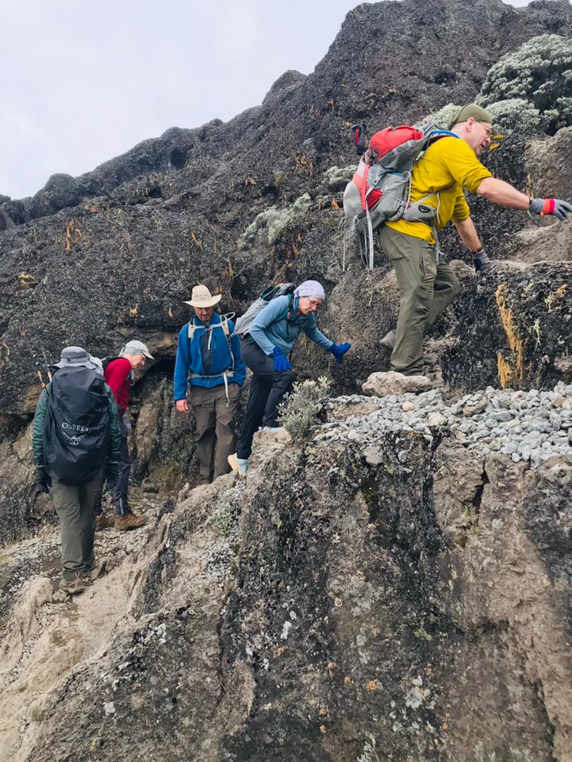
As the shortest and the steepest trail to Uhuru Peak, Umbwe is perhaps the toughest route, requiring hikers to scramble over rocks and walk along exposed ridges in a steady approach to the summit. Umbwe is also one of the quietest, lesser-traveled trails, and offers some of the most spectacular views of any from the mountain. Hikers ascend rapidly before joining those from the Machame Route at the end of the second day, and then follow the Southern Circuit beneath the Southern Ice Field before approaching the summit. Umbwe is only suited for strong, experienced hikers who can acclimatize relatively quickly.
WhatsApp: +255 763 951 976